


Gwangju’s Obscure Northern Rim
By Isaiah Winters
To usher in the cold, northerly winds of the new year, this January we’ll pay tribute to Gwangju’s obscure northern rim, specifically the flatlands, foothills, and jagged ridges just shy of Jangseong. The area contains a little-known green tea field, poignant ruins of an ancestral shrine, and an imposing, saw-toothed mountain that most just tunnel through on their way to more important places. So, join me as I flip through my personal Atlas Obscura of Gwangju’s northern no man’s land.
If you’ve ever traveled from Gwangju to Seoul, chances are you’ve passed through the nowheresville that is Nammyeon, a tiny township of just 3,700 souls where Gwangju’s northernmost suburban sprawl suddenly peters out into farmland. Though officially part of Jangseong County, Nammyeon’s location on the Gwangju side of the mountains makes it seem disconnected and out of place. With their backs against the sleepy foothills, residents of Nammyeon continue life at a slow pace, though likely with one eye on the encroaching metropolis unfolding before them. The other eye is likely on their buoying property values, which I presume are looking pretty good.
One parcel of land in Nammyeon that’s likely worth a lot these days is a massive green tea field bounding up the foothills just west of Highway 25. I was very surprised to find it this fall, and I presume many long-term residents of Gwangju would be surprised to know it’s there, too. Though Boseong’s renowned green tea field is far more impressive, the fact that Gwangju has its own humble version just a few minutes north of Cheomdan is very convenient for anyone wanting to enjoy a walk through a gently rolling yet precisely manicured hillside. Now I plan to visit every season to stroll its meandering, Boseong-esque trails and photograph the changing hillscape.
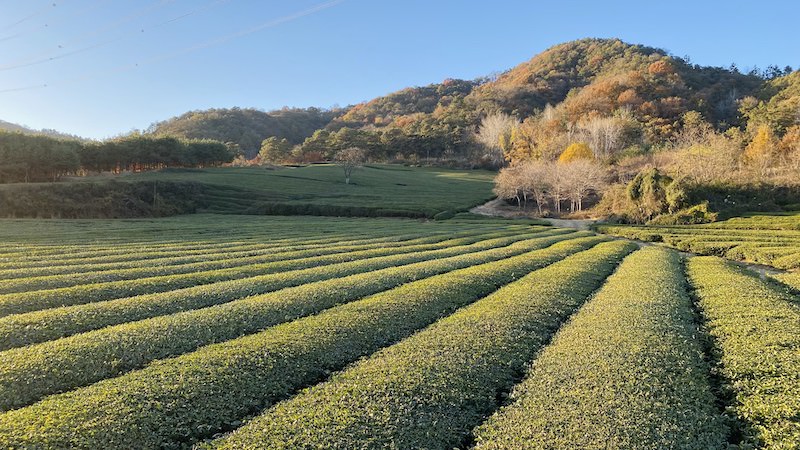
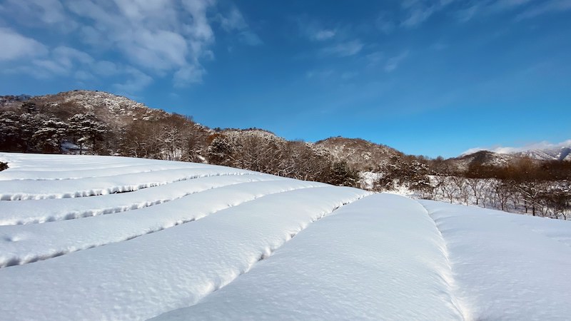
Owned by Hankook Tea Company (한국제다), the field dates back to 1965, with the oldest shrub sections now being nearly 60 years old. Apparently, this unassuming hillside is the northernmost large-scale green tea plantation in the country.1 Grown organically since 2009, the leaves here are harvested three or four times a year from late April to late August, with each harvest producing a different quality of tea. Given the cold snap that brought freezing temperatures and blankets of snow last December, there’s a chance the first yields of 2024 may be affected. We’ll have to wait and see.
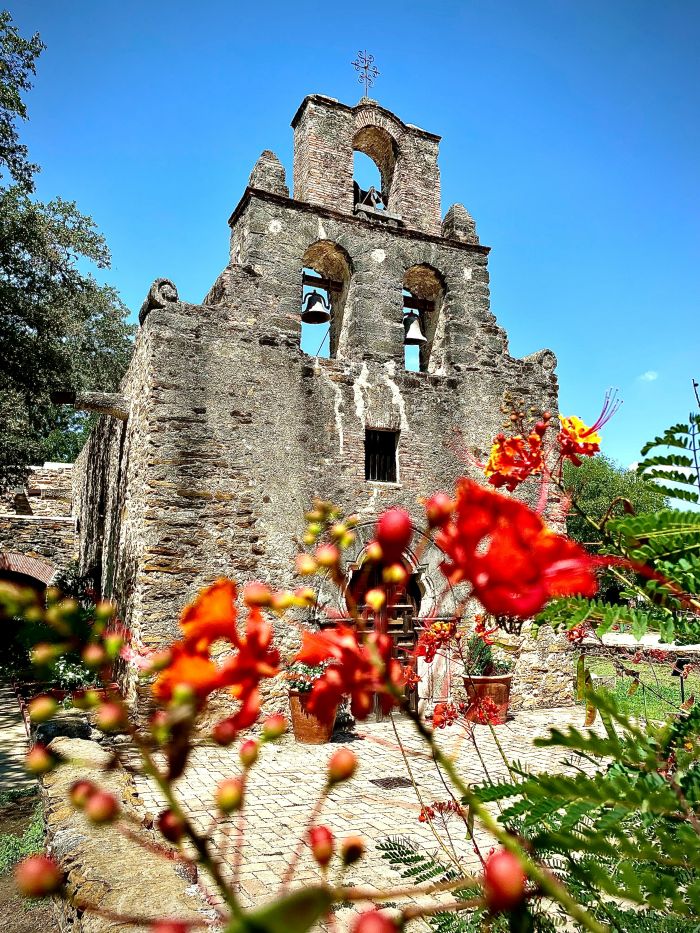
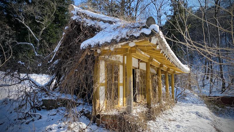
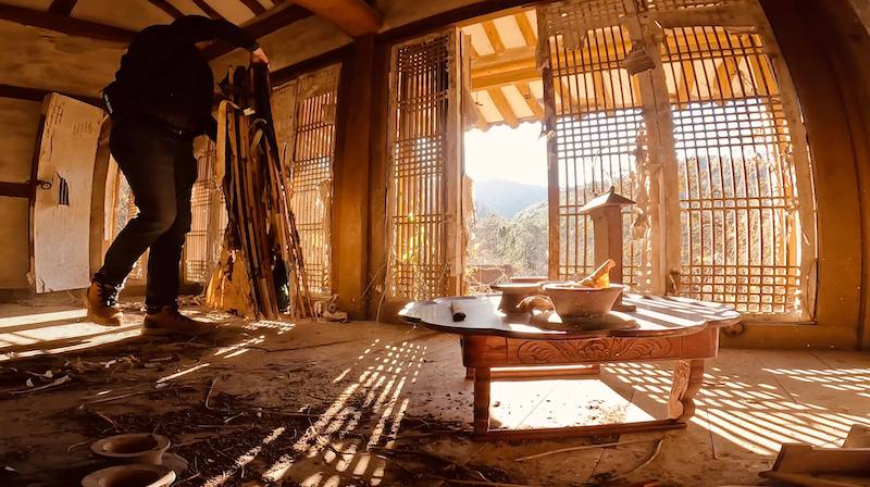
When I’m in the area, I enjoy driving the winding roads along the hillside and just spacing out. I recently discovered that one of these unassuming roads is a shortcut over and through the hills to Jangseong, and along the way is a badly damaged ancestral shrine that catches an amazing amount of direct sunlight just before the sun sets over the hills to the west. It would have been great to include in my article on ancestral shrines last month, but I discovered it too late in the magazine’s production process and so had to leave it on the cutting room floor.
Though the pillars appear sturdy, and the structure is likely only a few decades old, somehow the back-left corner suffered terrible damage some time ago. If you stand at just the right angle, you can see both its solid, sunlit façade and gaping collapse in the back shadows. The stark contrast is surely symbolic of something, though I’m not quite sure what. On my most recent visit, I slipped in the snow and fell into a deep ravine nearby while trying to get inside, and in that moment, I thought about how quickly our fortunes can change. Maybe that’s the symbolism this place embodies.
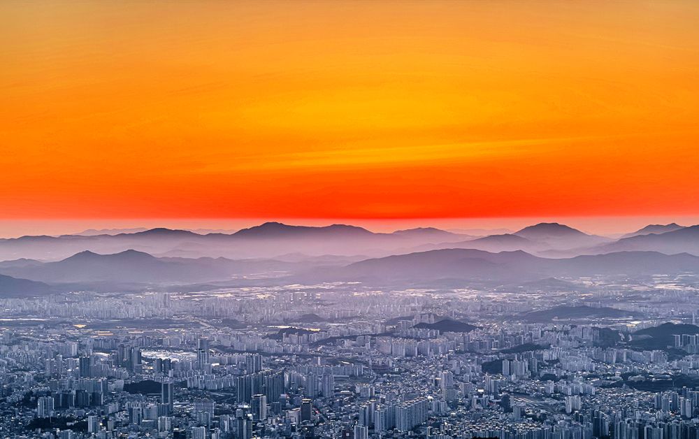
When I’m not cruising the area for green tea fields or abandoned sites, I’m usually hiking the nearest mountain, Bultae-san. At a sheer 720 meters, there’s nothing blocking your view of Gwangju once you reach the summit, and the ridge leading to the top on either end offers several vantage points that are as good as the main peak itself, so there’s honestly no real need to visit the highest point except to say that you did. I rarely bother with the peak anymore, especially if I’m already satisfied with my photos for the day.
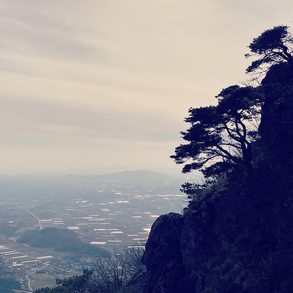
Admittedly, this hike is a hard slog if you approach the mountain from its flanks. Getting to the top ridge takes forever, and when you finally do, you’re greeted with an obstacle course of knotted ropes, nearly vertical staircases, and perpendicular peaks that you’ll have to scale and descend repeatedly as you traverse the saw teeth. I’ve approached the summit four different ways and found that three of them take too long, so these days, I prefer to park at Hakdong Village (학동마을) and hike straight up from there. If you go, be prepared for a full-body workout.
And there you have it, dear readers – a few of the overlooked sites directly to our city’s north. They’re easy to find and worth a visit if you’re ever in no man’s land.
Photographs by Isaiah Winters.
Source
[1] 호남다원 [Honam Tea Estates]. (n.d.). Hankook Tea Company. http://www.hankooktea.co.kr/sub.php?PID=0103
The Author
Hailing from Chino, California, Isaiah Winters is a pixel-stained wretch who loves writing about Gwangju and Honam, warts and all. He’s grateful to have written for the Gwangju News for over five years. More of his unique finds can be seen on Instagram @d.p.r.kwangju and YouTube at Lost in Honam.